Association of Polar Early Career Scientists


Understanding science is important for everyone, whether it is used for evidence-based decision-making, managing industrial companies, for employment, in voting as private citizens, or in making decisions about your home and family. Science communication is an important part of conducting research, especially in polar regions where access to in situ information is challenging for the public to obtain. The goal of this blog series was to breakdown some important topics in polar research so that a general audience can understand the key concepts.

There was one blog released each day during Polar Week with topics such as glaciers, sea ice, permafrost, paleo-climate, ice cores, and more! Changes happening in polar regions have global impacts, and everyone should be informed about the science happening there.

Arctic Climate Change and Midlatitude Weather- Why You Should Care about What’s Going on up There

You might have heard the news. More records are being set in the Arctic for sea ice loss all the time lately. Most recently in March, the Arctic set a record for the lowest winter sea ice maximum since the advent of satellite observations of the Arctic in 1979. That sounds bad for the Arctic right? But most people don’t live in the Arctic and there are no residents at all in the Antarctic. So why should you care?

It turns out that when there is less sea ice, there is more open water with which the atmosphere can interact. Such interactions include large fluxes of heat from the water to the air. This heat can change the location weather driving system known as the Jetstream. You’ve probably heard Al Roker talking about the Jetstream before, but I can simplify what this is even more. The Jetstream is also called the polar front, a boundary between the colder air from the poles and the warmer air from the tropics. When the boundary is to your south, your weather will get colder. When the boundary is to your north, weather is warmer.

My Master’s Degree research shows that the open water causes this boundary to move dramatically northward over western North America. Because weather comes in waves, eastern North America experiences a trough in the Jetstream leaving a large region much colder than they would be in the Autumn following an extreme ice loss event like that of 2007 or 2012.

The Past is the Key to the Present: Constraining Past Glacier Movements Using Surface Exposure Dating

Now, more than ever, it is important to constrain past glacier movements so that we can predict how modern glaciers will respond to current and future global warming. Due to the diminishing extent of sea ice each year and a series of positive feedback loops, the Arctic is experiencing amplified warming compared to the rest of the globe. Therefore, constraining the past movements of glaciers is even more important in these areas. Surface exposure dating is a versatile geochemical method that has expanded the geologist’s ‘toolbox’, allowing ages of past glacial movements that occurred thousands of years ago to be known. If we know how the glaciers were responding to different climates at those times, this helps us understand what will happen as our climate changes. Exposure dating tells us how long a particular material has been exposed to cosmic rays bombarding Earth, and can be done on both glacial landforms left behind by both the Greenland Ice Sheet and valley glaciers, both reservoirs of ice that will contribute to global sea level rise.

During my graduate work, I have had the opportunity to conduct exposure dating on boulders left by both glaciers and ice sheets in the past. During the summer of 2015 I traveled to the Petermann Glacier in Northwest Greenland to collect rock samples that will give us an indication of how it and the contributing Greenland Ice Sheet has been retreating over the past 10,000 years. Lateral moraines are sinuous ridged hills composed of boulders and glacial material that run alongside, parallel, to the glacier. They represent a time with the glacier was larger, wider in this case, for that hill to be right next to the glacial ice. Today, this lateral moraine is located 25 m away from the glacier, stretching 5 km alongside the glacier. We collected pieces of the uppermost surface of boulders along this moraine, selecting only boulders that fit our sampling criteria. We are looking for boulders located on the ridge of the moraine that are fairly large, usually ~1 m3, and that are composed of a non-local rock type. Washington Land and Daugaard-Jensen Land are composed of carbonate bedrock; formations of limestone, dolomite, and other rocks formed in deep marine waters. Carbonate rocks do not contain the mineral quartz, which is our target for this type of cosmogenic surface exposure dating. Therefore, we sampled primarily granite and sandstone boulders, which contain enough quartz for our analysis. By targeting non-carbonate boulders, we can be sure that the Petermann Glacier transported the rocks from a location in the interior of Greenland before being deposited on the lateral moraine.

Once we returned to the University of Wisconsin-Madison, we crushed each rock sample to sand size, and isolate the quartz minerals using magnets and density separation methods. Next we use strong acids such as hydrofluoric and hydrochloric acids to dissolve the quartz into a clear solution. The final steps require isolating the Be from all the other elements present in the quartz. Finally, we oxidize the Be and send it to an accelerated mass spectrometer to be measured. Once we have all the results, we can calculate the time that specific boulder was exposed to the atmosphere, interpreting this time as how long ago the glacier left the boulder on the landscape. Combined with results from the other boulders, we can understand how old the lateral moraines are. The age of the moraine might represent a climate event that could be reflected in the sediment cores collected by collaborating research groups investigating the paleoclimate history of the Petermann Glacier using marine fauna.

Liz Ceperly blog

Photo: Trek to the Petermann Glacier

The frozen history of the Earth – Reconstructing the past climate through ice cores

Usually, we learn about the history by reading books or textbooks. Letters and words of our spoken language tell us about the evolution of society in the past centuries or millennia. Alternatively, we rely on archaeological data; however, another historical archive exists that contains information about the history of the Earth’s atmosphere. It is written neither in English nor in any other human language, but rather it is written in a “chemical” alphabet. This “language” is preserved in ice cores: the greatest historical textbook ever written.

When snow descends from the atmosphere, air bubbles are trapped inside the flakes. These bubbles contain part of the atmospheric composition. For example, they contain carbon dioxide or methane in the same concentration of the surrounding atmosphere. In some regions, where temperatures don’t rise over the 0°C (i.e. Antarctica, Greenland or over high alpine areas), these snowflakes land and slowly build into large masses of ice, trapping the information about the atmospheric composition. The past is the key to the future, and in this way past climates can help us understand current and future climates.

Year after year, century after century, and millennia after millennia, the ice continues to grow becoming an incredible archive of information about the past climate. In other words, every year a new page of this unique historical textbook is written. But how does one read this book?

Once an ice core is extracted, scientists can decipher the climatic information using sophisticated analytical techniques. This translates the chemical language into an accessible language revealing what is stored in the ice. As the Rosetta Stone helped archaeologists to understand hieroglyphics, here, analytical chemistry is fundamental to understand the Earth’s past climate.

How long is this “Climatic Book”? It is a book of tremendous length! If for you The Lord of the Rings is long to read, the longest ice core is 600 times longer, assuming that one page corresponds to one year. As a matter of fact, the longest ice core ever drilled lets us understanding the previous 800,000 years of the Earth’s climate.

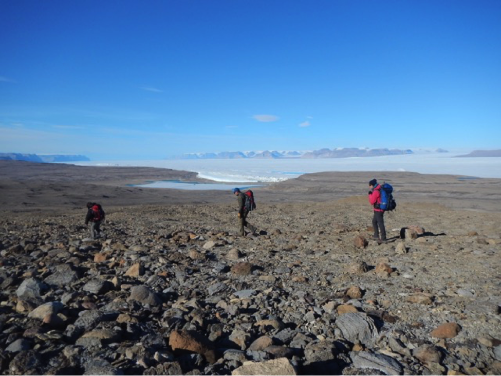
Nowadays, because of climate change, this heritage is endangered. To protect this melting record, an incredible project named “Protecting Ice Memory”, developed by the University Ca’ Foscari of Venice, the Italian National Research Council and some other French Institutions, was launched in 2016. The aim of this project is to drill several ice cores from glaciers all around the world (i.e. Mont Blanc, Illimani Glacier in Bolivia, Grand Combin in Switzerland etc.) in order to store them in Antarctica. Once there, the ice will be safely preserved for future generations that, with improved analytical techniques, can make discoveries which are impossible nowadays.

The fire at the Royal Library of Alexandria destroyed one of the most significant libraries of the ancient world. Its destruction has become a symbol for the loss of cultural knowledge. Losing the memory of the ice can be seen in the same way for the scientific knowledge it preserves. This is the reason why we have the moral duty to Protect the Ice Memory.

For more details on the Protecting Ice Memory project check out their website or see the official Facebook page.

Website: https://en.ird.fr/all-the-current-events/news/press-releases/cp-2016/protecting-ice-memory
Facebook: @ProtectingIceMemory

Antarctic Lakes - Nature’s Laboratory

The name ‘Antarctica’ generally reflects an image of a large icy continent thoroughly covered with ice and snow. With this cover and below zero-degree temperature, nobody imagines the presence of lakes in Antarctica. But, in fact, there is about 2% ice free area which is home to many lakes in Antarctica. Climate change is not restricted to the scientific community rather becomes a global issue. Lake study help in identifying the effect of climate change on aquatic organisms. Antarctic lakes are well suited for such studies.

Lakes in Antarctica differ in composition, size, hold unique environmental settings for biological organisms, and vary from coastal to inland settings. They exist from hypersaline to freshwater lakes with varying degrees of temporal or permanent stratification. Most of the lakes are prominent and visible during summer time. During winters, lakes freeze. In some deep lakes, only the upper layer of water freezes that acts as insulator, preventing the lakes freezing to the bottom, thus sustaining life within it. Isn’t it amazing that life can somehow flourish in the coldest place on earth?

Technological advancement has made it possible to see what lies below thousands of meter of ice without having to physically go down beneath it. Using a technique called Radio Echo sounding, scientists have found lakes buried under and ice sheet thousands of meters thick. These lakes are known as ‘sub-glacial lakes’. Radio Echo sounding is an airborne technique that sends radio waves from aeroplane and collects the reflecting waves to detect the interface of ice/bedrock; ice/water etc. Lake Vostok is the largest among the identified approx 400 subglacial lakes, measuring 250km long, 50km wide at its widest point and covering an area of 12500km2 under the Russian Station in Antarctica. This fresh water lake is approx. 4000m under the surface of the ice.

Despite extreme conditions, life thrives in Antarctic lakes. These lakes are different from lakes in the rest of the world, both because of their biological diversity and because of the severity of the physical and chemical factors associated with them. In order to survive in these lakes, organisms must be able to withstand several stresses. Phytoplankton (and other organisms) in Antarctic lake ecosystems have to adapt to survive through many conditions. First, during the long dark winters with very low temperature, which limit Photosynthetically active radiations (PAR). During this time there are low nutrient levels and low oxygen levels. Then, this changes to austral summer with 24-hour sunlight and availability of high intensity PAR. During this time there are increased nutrients, oxygen and temperature. Change in photoperiod (that is continuous dark or light period) limits biological diversity in Antarctic lakes, which plays a major role in the Antarctic food web.

The study of Antarctic lakes and its organisms are very important since these lakes are natural laboratories for studying evolution of microorganisms, and their adaptations towards extreme conditions. The study of such cold-loving microorganisms not only enhances the understanding of the scientific community about the unique microbial world but also has applications in biotechnology. It is very interesting to note that about two hundred patents have been filed related to actual or potential commercial biotechnological applications based on Antarctic genetic resources. Antarctic microbes may have application in the fields of medicine, nanotechnology, energy production and agriculture. They are delicate ecosystems that quickly respond to climate change, indicating the indirect impact of human activities.

Swati Nagar blog1

Photo Courtesy: Priyankar Datta

Polar Contaminants

When thinking about the polar regions (Arctic and Antarctic) one of the first things that comes to mind is a remote, pristine place. Unfortunately, this isn’t the case. Due to human activities all around the world, some contaminants are reaching the poles at concerning levels. Our planet is a network of connected systems, so what happens in our countries at lower latitudes has an impact on the polar regions. In turn, we will feel the effect of changes happening in other regions of the world. Furans, cadmium, lead, dioxins, chlordane, selenium, PCBs, DDT, mercury, and radioactive fallout are now a part of the polar ecosystems. Although the pollution levels in the high latitudes aren’t as high as in the industrialized areas of North America, Europe and Asia, it is still concerning.

The human population in the polar regions is small, so most of the contaminants that are found there are not produced or released to the environment there. The poles are contaminated because we are polluting other areas of the world. For example, the ozone hole (a region where the Ozone layer is thinner, which allows harmful ultra violet light (UV) to get through the earth’s atmosphere) is situated over the South pole and it was caused by the pumping of chlorofluorocarbons (CFCs) by the industrialized world over a long time period. This is one of the best examples of pollutants that are produced in one place having an effect on another.

So how do those contaminants get there? Through global systems like atmospheric circulation and ocean currents! Global atmospheric circulation carries near surface air pollutants from mid-latitude areas and brings them to higher altitudes in the polar region, where they descend again and are deposit in the soil, water or snow. The atmospheric contaminants can accumulate in glaciers and be discharged again to the environment when the ice starts to melt. It is still possible to find DDT (a toxic pesticide previously used worldwide) in Antarctic glaciers, and it was banned in 1972! Pollutants also reach the poles through ocean currents that move water around the globe. Chemical pollutants released from industries are carried by rivers to the oceans and then they move North or South via these ocean currents, and finally into the polar oceans.

These contaminants have a large impact on what has long been regarded as one of the most fragile ecosystems on the planet. Impacts include behavioural changes in animals such as changes in foraging habits, and even foetus and egg development. Similarly, soils can be infertile. Concurrently with global warming, sea level rise, ocean acidification, these stress factors are putting the fauna and flora in a very vulnerable habitat in danger.

Artic and Antarctic regions can be seen as “the canary in the coal mine”. Due to their unique environmental conditions they can work as an indicator and warning sign for what we are doing to our planet. So what can you do to try and stop this? At the global level it is difficult, as most of these contaminants are produced by large scale industries, mining extractions and transportation of people or goods. But at a local level we can monitor and regulate contaminants we put in landfills and release to the environment. And at an individual level, everyone can start changing small habits, using more efficient modes of transport, decreasing energy consumption, and start following the 3 R’s (Reduce the waste that we produce, Reuse things instead of throwing things away, and Recycle what you can). This will slow down the production and emissions of these pollutants and will help to maintain the conditions that we need to live on planet earth.

Future of the Cryosphere: Melting Glaciers and Thawing Permafrost

Glaciers and permafrost are components of the cryosphere (derived from the Greek words kryos for “cold” or “ice” and sphaira for “globe”, i.e. the frozen parts of the Earth system). Since they represent a thermal condition, they are intimately linked to climate. Over the next century, climate is projected to warm by several degrees, and worryingly, we are already seeing the loss of glaciers and permafrost worldwide.

Glaciers (from the French word glace for “ice”) are masses of ice which form where snow accumulates more than it melts during the summer months. This causes layers of snow and ice to build up, which is gradually compressed into ice by the weight of the overlying layers. Glaciers predominantly occur in the ice sheets of Greenland and Antarctica as well as in smaller masses throughout the Arctic and at high elevations. Glaciers impact global climate by reflecting incoming solar radiation (known as the albedo effect) and keeping the climate mild. Once they disappear, the darker land surface below absorbs radiation which causes more warming and ultimately more ice loss, a process called a “positive feedback loop”. Glaciers are also important early indicators of climate change as they react faster to warming than other parts of the Earth system. Once the ice melts, it flows into the sea and causes the sea level to rise around the globe and change the chemistry of the ocean. Glaciers are also the largest store of fresh water around the planet, particularly alpine glaciers near the Equator. Once these glaciers disappear they will no longer provide fresh water to these regions. Science plays an essential role in helping to better understand glacial dynamics and change so we can accurately model future impacts of climate change.

Jean Holloway blog1

Photo: Nordenskiöldbreen is a glacier located in Spitsbergen, Svalbard. It is the first glacier I ever saw in person and I was mesmerized. The blue ice is breathtaking. The bit of rock sticking out the top is called a “nunatuk”.

Permafrost is ground (rock or soil) which stays below 0°C for two or more years. Its presence is linked to cold climates, and is therefore only found at high latitudes and altitudes. The depth of the permafrost is linked to how long the air is cold – longer cold periods lead to deeper permafrost. Some areas at the highest latitudes and altitudes are underlain by thick, cold permafrost which will mostly remain unchanged over the next century. However, it is expected that permafrost will disappear completely at more southern latitudes and lower altitudes where it is thin, discontinuous, and just below 0°C. Permafrost thaw is important in several ways. Firstly, the thaw in regions where permafrost contains an abundance of ice can lead to ground settlement as the ice melts and flows away. Ground settlement can change local hydrology and ground stability, and be damaging to ecosystems and highly destructive to infrastructure. Secondly, some permafrost contains old frozen plant material and carbon, and thawing of this permafrost will release this carbon into the atmosphere, acting as another positive feedback loop to climate change. It is imperative that we better understand how permafrost is transforming so we can predict and adapt to future changes as the climate warms.

Jean Holloway blog2

Photo: Drilling a borehole to measure the temperatures of permafrost near Fort Providence, Canada. We are monitoring changes in permafrost conditions following forest fires, which are increasing in frequency and magnitude as the climate warms.

Contact APECS

APECS International Directorate
UiT The Arctic University of Norway
Huginbakken 14
9019 Tromsø
Norway
Email: info(at)apecs.is

Our Sponsors

APECS Directorate Sponsor
 
UiTNPIFRAM
 
Further Sponsors and Partners for APECS projects, activities and events